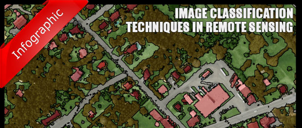
The image classification plays an important role in environmental and socioeconomic applications. In order to improve the classification accuracy, scientists have laid path in developing the advanced classification techniques. However, classifying a remotely sensed data into a thematic map is still a nightmare because of the following factors such as landscape complexity, image sensing and processing and classification approaches. The review concentrates on recent classification approaches and techniques which are often not available.
a) Remote sensing classification process RS classification is generally a complex procedure which needs many factors to be considered. This procedure includes following steps that begins with the identification of suitable classification system, choosing appropriate training samples, processing of an image and extracting its features, applying a right and indeed classification method, post classification and accuracy assessments.
b) Selection of remotely sensed data Airborne and space borne sensor data comes under RS data stream, which varies in spatial, radiometric, spectral and temporal resolutions. In order to have better image classification a suitable RS data needs to be collected, which depends upon strength and weakness of sensor data. In literature the characteristics of remotely sensed data is summarized by in spectral, radio metric, spatial and temporal resolutions with polarization and angularity.
It is preferred to consider the factors while selecting suitable sensor data as per the user’s need, which includes scaling, study area characteristics, availability
of various image data and their characteristics, cost, time constraints and analyst’s experience in using selected images. Scaling determines the study area; earlier research encountered a problem of image resolution of remotely sensed data in classification. In regular practice, a fine-scale classification system is adopted in order to achieve high spatial resolution data.
For example, IKONS and SPOT 5 HRG are at regional 17 level medium spatial resolution data. However, the influence of atmospheric conditions in moist and tropical regions cannot be neglected and they are often an obstacle for capturing the high quality sensor data. Therefore, it always proves to be beneficiary to have multiple sources of sensor data.
c) Selection of classification system and training samples A better classification can be achieved only when we consider a suitable classification system with sufficient number of training samples. Generally, in a wide variety of applications we adopt hierarchy classification systems because different conditions are taken into account.
A classification system should consider spatial resolution of selected RS data, compatibility with its previous work, image processing and classification algorithm availability and time constraints. The ultimate goal of choosing any classification system is to satisfy the need of an end user.
The image classification broadly depends on of training samples and their representativeness. Training samples can be prepared by fieldwork or it can also be obtained from other means such as aerial photographs of fine spatial resolution and satellite images. The results of the classification are affected by the selection of training data, which generally may be based on single pixel, seed or polygon, also affected by fine spatial resolution image data if proper care is not taken. If coarse resolution data is used for classification data then the selection of TS becomes tedious under complex and heterogeneous case studies as it contains large volumes of mixed pixels.
d) Data Preprocessing The image preprocessing is a technique which includes detection, restoration of bad lines, geometric rectification, radio metric calibration, atmospheric and topographic correction. If data is collected from different sources, it is necessary to check the quality before stepping into classification. If the single data image is utilized in classification atmospheric corrections may not be required but on the other hand it becomes mandatory for a multi-sensor data. A variety of correction techniques are presented. If the study area includes rugged or mountainous regions a topographic correction is needed, which is detailed.
e) Feature Extraction and Selection The quality of an image classification depends on the selection of suitable variables. A variety of variables used in classification includes spectrum signature, vegetation indices, transformed images, textual information, multi temporal images, multi sensor images and ancillary data. The process of feature extraction is needed in order to minimize data redundancy in remotely sensed data or to excavate specific land cover information, that includes principle component analysis, minimum noise fraction transform discriminant analysis, decision boundary, feature extraction, non parametric weighted feature extraction, wavelet transform and spectral mixture analysis.
f) Selection of suitable classification method The question of choosing a classification method is ambiguous because many factors such as spatial resolution of RD, multi-sensor data, availability of different classification software are involved. Each classification method has its own merits and demerits.
g) Post classification processing Classification confusions arise in the regions such as urban areas, for example, consider between commercial and high intensity residential areas or between recreational grass and crops. In present example to reduce classification confusions we need to consider the property of spectral signature because it is similar to commercial and high intensity residential areas but on the other hand their population densities are different. Pasture and crops are largely located away from residential areas with sparse houses and low population densities, at this stage expert knowledge can be developed based on the relationship between housing or population densities and urban land use classes to help separate recreational grass from pasture and crops.
Evaluating the classified results is an important step in classification procedure. The evaluation process may include qualitative evaluation based on expert knowledge to quantitative accuracy based on sampling strategies. The classification accuracy assessment is the most common approach for the evaluation of classification performance .
a) Classification of accuracy assessment By the knowledge of sources of errors, classification accuracy assessment can be implemented in addition to classification error, position error, which resulting from registration, interpolating error and poor quality of training which may affect the classification accuracy. The classification accuracy assessment includes three basic steps
1.Sampling design,
2.Response design,
3. Estimation and Analysis procedures
b) Advanced classification procedures The advanced classification procedures such as neural networks, fuzzy sets and expert systems are highly applied for image classification. In general image classification approaches it can be grouped as supervised or unsupervised, parametric and nonparametric or hard and soft classifiers or per pixel, sub pixel, per field. Table provides brief description of these categories.
c) Use of multiple features of remote sensed data Any remote sensed data generally contains many unique and special spectral radio metric temporal and polarization characteristics;
the effective use of these features can improve the classification accuracy. The summary of table presents the research efforts in order to improve the classification accuracy by considering the features of remote sensed data.